Teacher Resources
Our purpose is the promotion and enhancement of geographic knowledge in the schools and among the general populace of Illinois. To achieve this purpose, the Alliance maintains a strong grassroots organization of geographic educators from schools and universities, participates in educational reform at the district, state, and national levels. We engage in an active program of preservice and inservice teacher education, develop curriculum materials based on the National Geography Standards, and foster public awareness of the importance of geography in our society.
New Story Map - Where Does Thanksgiving Dinner Grow?
The Thanksgiving Dinner Story Map can be found at: https://arcg.is/Cznmn.
A story map is an interactive map that contains information about the maps and what they show. Story map users can interact with the data behind the map, for example, users can click on a state to see how many acres of carrots (or other Thanksgiving foods) and the number of turkeys or bushels of wheat are grown in a particular state.
A big thanks to Linda Zellmer, Government Information & Data Services Librarian at Western Illinois University (Macomb, IL) for developing this new story map.
Explore the Geography of Thanksgiving Dinner
Resources for exploring the geography of Thanksgiving dinner are available at http://faculty.wiu.edu/LR-Zellmer/thanksgiving.html thanks to Linda Zellmer, Government Information & Data Services Librarian at Western Illinois University (Macomb, IL).
Current maps and posters are available. Older editions are still available for comparison. (Note: If you do not have access to a plotter, you can print the poster on multiple sheets of 11 X 17 paper by selecting 11 x 17 Landscape in Page Setup. Then choose Custom Scale and enter 70%. The poster will print on multiple pages and can be pieced together for a bulletin board.)
Linda shares that one teacher that has used these resources would "teach nutrition and get the food ads for the grocery store during those weeks. The kids would plan a balanced menu, figure out how much food they need to feed the class (number of turkeys, pies, etc.), and then calculate how much it would cost to feed the class (you can get serving sizes from https://www.choosemyplate.gov/). Thus, they learned some geography, nutrition and math!"
New Esri GeoInquiriesTM for a New School Year!
Please share the new Esri GeoInquiries for Mathematics, American Literature, and World History with your colleagues. If your school would like to have a copy of all of the GeoInquiries (including Mapping Our World) loaded into its ArcGIS Online organization, please see details here. GeoInquiry collections are also available for Earth Science, AP Human Geography, US History, Elementary, Environmental Science and Biology.
New Ways to Explore with Google Earth
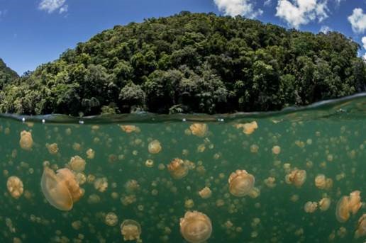 Photo Credit: Enric Sala
Did you hear the news? National Geographic has teamed up with Google Earth so you can show your students the world without leaving the classroom. Check out our free educational resources and join Nat Geo Explorers such as Paul Salopek in the field with map-based stories. See why other educators use these resources to empower our next generation of explorers.
Celebrating the National Historic Preservation Act
In honor of the 50th anniversary of the National Historic Preservation Act (NHPA), teachers and classrooms can use the NHPA site to watch videos of each state's archaeological sites for the preservation and recording of historic places.
Since 1966, the NHPA has helped to preserve hundreds of thousands of archaeological sites and created scientific excavation sites all over the U.S. Find out how volunteer groups nationwide have created educational videos of their archaeological sites for storytelling. Currently there are 17 state videos that are each less than 30 minutes long, which is ideal for integrating into a classroom.
With every historical site and excavation site, the NHPA has helped to foster the good stewardship of historic places.
Education Resource You Decide: Presidential Decisions Brings Interactive Experience to the Classroom
Check out You Decide: Presidential Decisions , an interactive experience in which students take on the role of the President of the United States and make complex decisions based on real situations faced by President Gerald R. Ford during his 1974-1977 presidency: the signing of the Helsinki Accords, the condemnation of South African apartheid, and Operation Babylift. The interactive experience also includes an educator guide to engage students in grades 6-12 with the interactive both in and out of the classroom. The guide includes information about the role of the facilitator, as well as game play setup for independent play, small group play, and whole class play. Activity ideas and discussion questions are organized into before, during, and after play.
You Decide: Presidential Decisions is an excellent companion to the social studies classroom, particularly any study of the Cold War era. It also highlights the importance of human rights to President Ford, and can lead to discussions about these rights and how presidents can advocate for issues that are important to them. The focus on decision-making in this interactive offers a way to introduce a powerful process that can be used in students' own decision-making, or in analyzing decisions they may read about in historical context or in current events.
Engage Students in a Walk Around the World
Pulitzer Prize-winning journalist Paul Salopek is literally walking around the world, retracing the broad migratory pathways of our ancient human ancestors and slowing down to tell stories of people's lives that might otherwise remain untold. Check out inspiring photos, maps, videos, and exquisite writing at the dedicated Nat Geo website for Paul's Out of Eden Walk.
Two educational partners provide related classroom materials and learning opportunities, free of charge.
The Pulitzer Center on Crisis Reporting offers lesson plans for students from elementary through university, exciting curricular and extracurricular programs, summer break ideas, and the reporting of hundreds of other journalists exploring themes touched on in the Out of Eden Walk, including forced migrations, food and water security, and climate change.
Out of Eden Learn, an initiative of Project Zero at the Harvard Graduate School of Education, also offers curriculum materials. In addition, they have developed a companion online learning community to promote thoughtful cross-cultural exchange, with thousands of school-age students from over 50 countries having taken part so far. Classes are clustered in diverse groups to follow "learning journeys" that invite them to: (1) slow down to observe the world carefully and to listen attentively to others; (2) exchange stories and perspectives with one another; and (3) make connections between their own lives and bigger human stories. Go to their website to register classes of all ages for Learning Journey 1. In addition, Out of Eden Learn is seeking high school classes to participate in its new Stories of Human Migration curriculum; email them if you are interested!
Statistics in Schools
Statistics in Schools is a free program from the U.S. Census Bureau offering data, tools, and activities that correspond with relevant education standards and guidelines and that use real-life census information for teachers to incorporate into their lesson plans. This is not just a math program--it includes geography, sociology, and history activities. Through this program, students can connect the world around them to what they are learning in the classroom.
Vendee Globe: The World's Greatest Teaching Tool
 Join the only American Skipper, Rich Wilson, as he competes in this year's Vendée Globe, a solo, round-the-world, nonstop sailing race.
Competitors set sail and finish in Les Sables d'Olonne in Brittany, France after rounding the Cape of Good Hope in South Africa, Cape Leeuwin in Southern Australia, and the infamous Cape Horn at the tip of South America. In 2008, 30 skippers started Vendée Globe, and Wilson placed ninth out of the 11 who finished. Wilson is president of the non-profit organization, sitesALIVE!, that has produced 75 live, interactive, semester-long, curriculum-based, learning adventures since 1990.
The drama of the Vendée Globe, its risk, and the uncertainty of its outcome, is certain to excite and engage a student audience. Curricular subjects that are unconvincing in textbooks become convincing in this real-world context. The race overflows with geography, science, math, history; with stars, flying fish, whales, birds; with nutrition, sleep deprivation, physical fitness; with materials science, physics, electronics, satellites, mechanical engineering; with aerodynamics and hydrodynamics; with solar, wind, hydro, and fossil fuel energy systems; with risk and isolation; with determination, decision-making, problem-solving, and perseverance.
Visit http://vg2016.sitesalive.com/signup6 to sign up for weekly email updates, sent each Friday morning. Once signed up, bookmark the website to check each day on Wilson's progress via boat position map and audio report, send a question for Rich or one of the Team of Experts to answer, or participate in the online Forum. Regular updates will also be posted via Facebook and Twitter.
Reach the World
Reach the World makes the benefits of travel accessible to classrooms, inspiring students to become curious, confident global citizens. Reach the World's programs transform the energy of travelers into a curricular resource for K-12 classrooms. Through our unique online platform, educators can match with a traveler whose backgrounds and interests are a close fit with the needs and academic goals of their students. Classrooms then embark on digital exchange journeys with their travelers-and expand their worldview, skills, and aspirations in the process.
Contact Christopher Ahearn (chris@reachtheworld.org) today to learn more and plan your virtual journey!
10 ESSA Issues to Consider
This report provides insight into key areas of the Every Student Succeeds Act that have prompted questions and concerns from education leaders and policymakers as they prepare to implement this new law: http://www.ecs.org/essa-quick-guides-on-top-issues/
Teach Atlas
A team from Illinois State University has developed a curriculum for 5th grade students that bridges technology, geography, social studies, science, and language arts. Learn more at teachatlas.com.
For questions about the curriculum, technology, adapting the materials for other grade levels, or workshops and training, please contact joel@teachatlas.com.
NCLB - ESSA Comparison
KnowledgeWorks has created a handy side-by-side comparison of No Child Left Behind and Every Student Succeeds Act.
Join the GeoMentors Community: A Nationwide Effort to Improve Geography and GIS Education
As part of the ConnectED initiative, Esri is donating free ArcGIS Online organization accounts to every K-12 school in the U.S. (account sign-up is available here). This gift introduces GIS software and geographic concepts into classrooms, allowing students to map and analyze data with the same technology used by government and businesses.
GIS is a powerful educational technology, but K-12 teachers already face considerable time constraints that can make it difficult to learn and implement a new resource. To address this need, Esri and the Association of American Geographers (AAG) are working together to develop a nationwide volunteer network of GeoMentors, knowledgeable GIS users who volunteer their time and expertise to help educators and administrators meet their classroom goals using GIS. The GeoMentors program maintains online maps and databases for collaborators to connect with each other, a curated collection of ArcGIS Online educational resources and curriculum materials, as well as several online groups and social media streams for community engagement and interaction.
To learn more about the program, visit www.geomentors.net, or register today to work with a GeoMentor or be one yourself! Contact AAG staff with any questions at geomentors@aag.org.
The GeoMentors community is ready and able to help make a difference in K-12 education with GIS!