Dedicated to the Teaching of Geography in the State of Illinois
Our purpose is the promotion and enhancement of geographic knowledge in the schools and among the general populace of Illinois. To achieve this purpose, the Alliance maintains a strong grassroots organization of geographic educators from schools and universities, participates in educational reform at the district, state, and national levels. We engage in an active program of preservice and in-service teacher education, develop curriculum materials based on the National Geography Standards, and foster public awareness of the importance of geography in our society.
News and Events
Summer Professional Development Seminar for K-12 Educators - The Reframing Lincoln Seminar: Myth, Memory, and Changing Narratives
The Gilder Lehrman Institute of American History has partnered with the Lincoln Presidential Foundation to present this year's Summer Professional Development seminar. The event is set to take place at the Lincoln Home National Historic Site in Springfield, Illinois, from July 19-24, 2026. It offers up to 30 educators from elementary, middle, and high schools the opportunity to participate in a one-week course examining Abraham Lincoln as a myth, a man, and a president.
The deadline for application submissions is March 6, 2026. Applications will be reviewed by the Gilder Lehrman Institute and Lincoln Presidential Foundation staff. Selected teachers will be notified the week of April 6, 2026.
To learn more about this opportunity, please visit Reframing Lincoln Seminar Information
Traveling Maps at Metcalf Make Social Studies Matter
The recent Traveling Maps at Metcalf Make Social Studies Matter article highlights the Giant Travelling Map of Illinois that Illinois teachers can borrow free of charge from the Illinois Geographic Alliance, LLC (IGA). For more information about the map and how to reserve it for your classroom, please visit Giant Map.
Resources from Esri
- Teaching topography (September's Earth science resource)
This post outlines four different teaching resources to help teach and inspire about this core topic.
https://community.esri.com/t5/education-blog/teaching-topography-september-s-earth-science/ba-p/1647378 - Redistricting and gerrymandering
This is a re-working and update of the GeoInquiry Gerrymandering activity.
https://community.esri.com/t5/education-blog/redistricting-and-gerrymandering-new-classroom/ba-p/1646703 - Experience GIS for Wildfire Management
This activity targets CTE students - blending key career concepts.
https://community.esri.com/t5/education-blog/new-activity-experience-gis-for-wildfire/ba-p/1646121 - Using MapMaker with a free ArcGIS public account
https://community.esri.com/t5/education-blog/using-mapmaker-with-a-free-arcgis-public-account/ba-p/1642493 - New ArcGIS for Schools Bundle Administration Guides
https://community.esri.com/t5/education-blog/new-arcgis-for-schools-bundle-administration/ba-p/1643851
NCGE Launches GeoCircles
The National Council for Geographic Education (NCGE) has launched GeoCircles, a free, monthly, virtual PD opportunity for geography educators that is facilitated by geography educators. For more information and to view the upcoming schedule, please visit https://ncge.org/professional-development/geoed-circles/.
Explore GeoCivics
Electoral redistricting is a nonpartisan topic that keeps communication lively and cuts across geographic areas and political perspectives. Explore resources from GeoCivics https://geocivics.uccs.edu/ including online redistricting puzzles, tools for mapping your community, and explanations of redistricting criteria. For an overview, check out this video
Resources for Illinois: https://geocivics.uccs.edu/stateresources/illinois
Questions? Don’t hesitate to contact Rebecca Theobald at geocivics50@gmail.com. Please share, as the more you and your communities engage with redistricting, the more voices will be represented.
-
Giant Traveling Floor Map of Illinois Loan Progam Up and Running Again
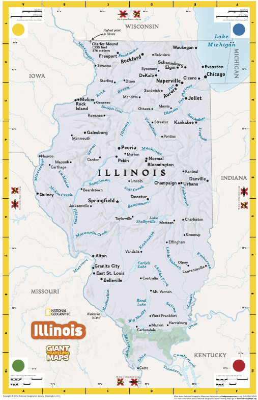
You can once again borrow a giant floor map of Illinois from the Illinois Geographic Alliance, LLC (IGA) for free!
The Illinois Geographic Alliance, LLC (IGA) received two Illinois Giant Traveling Maps from the National Geographic Society. To advance our educational mission, the IGA will make these maps available to schools, organizations, and communities in Illinois free of charge. The standard loan period is one week.
Visit the Giant Traveling Floor Map page of the IGA website for more information.
Please email iga@illinoisState.edu to inquire about map availability and to make your reservation.